
SEATTLE — Puget Sound Extended Forecast
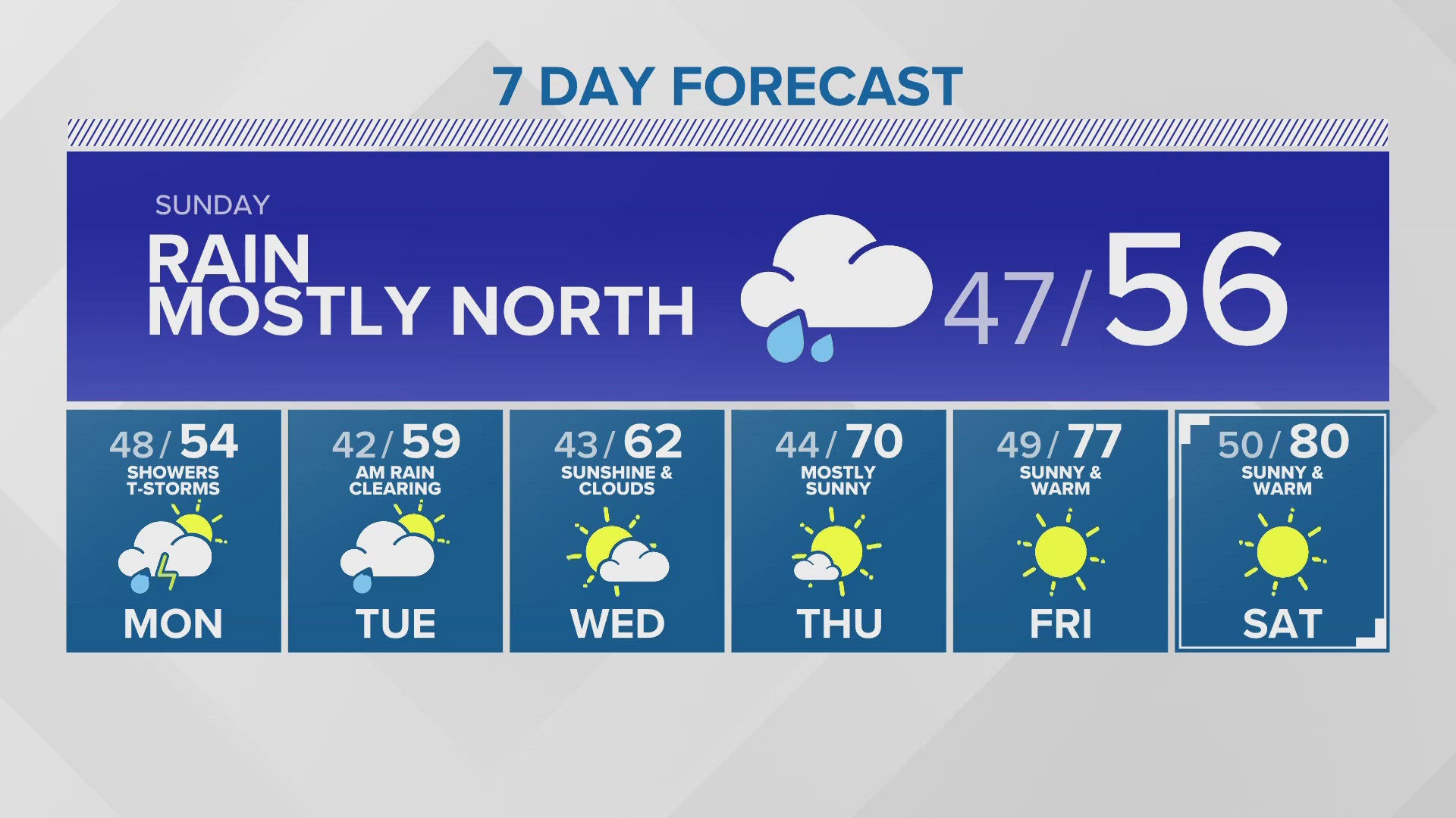
Sunday & Monday: Showers mixed with sunbreaks. Best chance for rain will be for Puget Sound and eastward on Sunday. Morning lows in the mid-40s. Highs in the mid-50s.
Tuesday & Wednesday: Partly sunny with a few showers. Lows in the low to mid 40s. Highs in the upper 50s to lower 60s.
Thursday & Friday: Mostly sunny and warming up. Lows in the mid to upper 40s. Highs in the upper 60s on Thursday and 70s on Friday.
Discussion:
Showers taper overnight, but two systems converge overhead on Sunday bring more rain and wind. Gusts get up to around 30 mph during the dinner hour and rain will be heavy in the Cascade foothills of Skagit, Snohomish and King counties.
On Monday, there will be cold air aloft and some sunbreaks that could create convection - a fancy way of saying that there could be thunderstorms.
But then... A ridge will begin to build by midweek and may stick around into the weekend - still some uncertainty on the specific details, but we will likely be in the 70s - and possibly 80s - for Mother's Day weekend!